NGA's Google Glass App Could Be Gateway to ‘Immersive Intelligence’

Few federal agencies are tapping the wearable technology's potential to enhance their missions and improve citizen services. That’s understandable, considering the wearable tech market is still in its infancy, and agencies would have to strike the right balance of usability, privacy and security.
But that hasn’t stopped the National Geospatial-Intelligence Agency from putting devices such as Google Glass and Oculus Rift to the test. The hope, Matthew McNerney, an agency subject matter expert, tells Jason Moll of NGA’s Office of Corporate Communications, is that apps NGA develops will “serve as gateways to the immersive intelligence experience being advanced by NGA leadership." McNerney is a visualization engineering expert in the agency’s research and development arm, InnoVision.
NGA developed its prototype app for Google Glass to boost situational awareness for operators working in the field at special security events or on sensitive law enforcement investigations. “It allows the user to send and receive information to another NGA application that creates a common operational picture, or COP, over the Web,” according to Zachary Swain, who wrote the application while working in InnoVision. The Air Force is also beta testing potential uses for Google Glass on the battlefield, VentureBeat reported earlier this year.
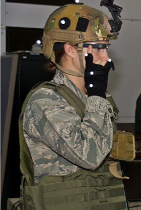
Credit: Richard Eldridge
2nd Lt. Krystin Shanklin tests Google Glass at Wright-Patterson Air Force Base, Ohio
In May, former NGA Director Letitia Long said the agency was transitioning from being a provider of static products into “a resource for dynamic GEOINT content, analysis, and services.” Part of that work includes delivering the next phase of intelligence: immersion. “By immersion, I mean living, interacting, and experimenting with the data in a multimedia, multi-sensory experience with GEOINT as its core,” Long said.
Ultimately, the immersive experience should help break down barriers that separate collectors, analysts, customers and decision-makers.
NGA’s prototype app for the virtual reality headset Oculus Rift, allows users to navigate so called 3-D point clouds created by light detection and ranging (LiDAR) scans. These 3-D point clouds give analysts a recreated view of various cities, complete with trees, power lines and buildings, Moll notes. Rather than viewing a two-dimensional image from their computers, Oculus Rift will provide a three-dimensional perspective and allow users to virtually fly over cities, walk along the streets, or collaborate with other analysts in the virtual environment.
“By immersing themselves in the same data, Oculus Rift could let two analysts see (their avatars), walk across the landscape, annotate what they see and communicate what they’re seeing — all in real time — and even if they are in different (physical) locations,” according to Eric Aasted, an InnoVision project scientist.
How is your agency embracing wearable technologies?