


Federal Tech Reaches from the Atlantic Ocean to a Volcanic Crater in Hawaii

Beyond the Beltway, many think of the federal government as a boring hive of bureaucrats packed along endless corridors in supersized buildings. But nothing could be further from the truth.
In reality, the government is home to some of the most unique jobs in the world — and some of the most intriguing uses of technology as well.
Whether studying the water on the surface of the sea floor or flying cross-country to help monitor and manage coastal resources, feds turn to technology, in many forms, to meet their varied missions.
We found some talented workers in the most interesting locations and asked them to reveal how technology helps them do their jobs.
Monitoring the Halema’uma’u Crater — Hawaii
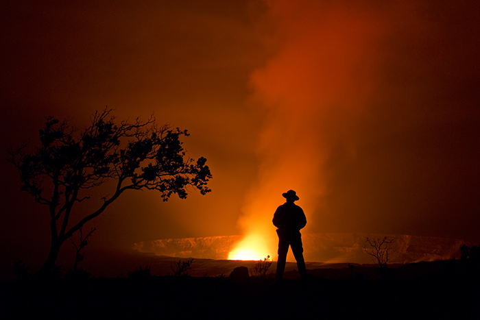
Park ranger Rob Ely overlooks the Halema’uma’u Crater, the erupting summit of Kilauea in the Hawai’i Volcanoes National Park. The U.S. Geological Survey mounts cameras that look into the crater, providing updated photos and, in some locations, a 24-hour live webcam feed.
Tracking Coyotes in Denali National Park — Alaska
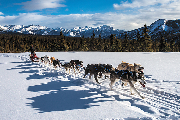
Park Ranger Corrie Lane rides with a team of canine rangers at Denali National Park in Alaska.
Rangers like Lane recently assisted a researcher in tracking the park’s coyote population, which has grown significantly over the past century. To do this, the team of rangers traversed remote parts of the park creating GPS waypoints when coming across animal waste. That data shows researchers the trails coyotes carve out and then use throughout the park.
Surveying Coastlines Aboard a King Air 350CER — Eastern Seaboard

Lt. Cmdr. Rebecca Waddington of the National Oceanic and Atmospheric Administration (NOAA) pilots a King Air 350CER aircraft based out of Tampa, Fla. Sophisticated sensors survey coastlines and disaster areas to inform emergency management decisions. The data also lets the government produce and regularly update national shoreline maps for marine navigation.
The fuselage of the plane includes two sensor ports that can incorporate a variety of remote-sensing systems, such as high-resolution digital cameras and multispectral and hyperspectral sensors. The ports also host Lidar, a type of laser scanner used for terrain and shoreline mapping.
Waddington says pilots use notebooks for mission planning and to operate onboard equipment. They also rely on iPad devices running custom software to help navigate mission flight plans.
Assessing Climate Change in Glacier National Park — Montana
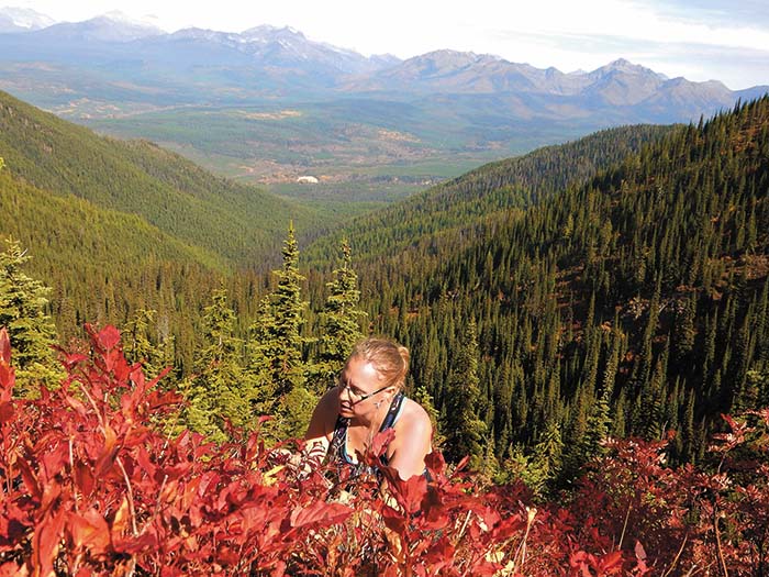
Tabitha Graves, a research ecologist for the U.S. Geological Survey, looks at the potential effects of climate change on bear foods such as huckleberries in Northern Montana’s Glacier National Park, near the Canadian border.
Graves’ team combined field observations with data taken from remote cameras to examine the relationship between huckleberry growth, the plant’s flowering and the number of berries each year. The agency used the data she and her team collected to develop predictive maps of berry productivity in the park. The agency also created a mobile app called ScienceCache to guide the public to huckleberry sites where they can take pictures to add to the data collection.
Marking Potential Gravesites on Betio, Kiribati — Pacific Islands
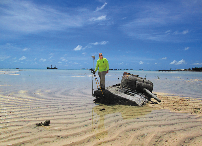
Steven “Rick” Bradshaw works as a geodetic surveyor for the National Geospatial-Intelligence Agency. His work took him to Betio, 2,400 miles southwest of Hawaii. The remote island is the final resting place of more than 100 U.S. Marines who fought the Battle of Tarawa in November 1943 during the height of World War II. Bradshaw volunteered for an assignment marking the coordinates of potential graves.
NGA plans to merge the collected data with mapping data from the Defense POW/MIA Accounting Agency to help identify Marines killed in the line of duty.
“If my efforts ultimately result in identifying just one missing Marine, or hundreds, I know that volunteering with this NGA effort meant I helped pay back something to those who sacrificed their lives for our country,” Bradshaw says.
Studying Aboard the NOAAS Nancy Foster — Atlantic Ocean
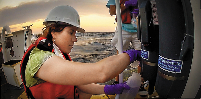
Nancy Prouty works as a research oceanographer for the U.S. Geological Survey aboard the NOAA Ship Nancy Foster, studying the ocean about 78 miles off the coast of Maryland. Here, she uses a Niskin bottle to gather water samples so that USGS can better understand environmental conditions at different ocean depths.
“The vessel itself is an incredibly important piece of technology,” she says. “We need to stay in one location for several hours. A computer-controlled system automatically maintains our position and heading by using its own propellers and thrusters, called dynamic positioning, to ensure we stay in the right location at all times.”