


What Is Drone Technology?
Drones carry out a range of missions for agencies, from mapping to disaster relief, search and rescue and video surveillance. Drones help agencies gather data, both for situational awareness and scientific purposes, in a more efficient manner.
The Interior Department is the steward of about 500 million acres of public land in the United States, Bathrick notes, roughly about one in every five acres in the continental U.S., as well as 1.7 billion acres in the outer continental shelf. Managing all of that land responsibly requires a lot of science, he says.
“Science comes from sensing and collecting data,” he says. “The drones give us the ability to collect more data.”
Romeo Durscher, director of public safety integration at drone maker DJI, notes that drones are data collection devices. “It gets us data, but it gets us data in a much more effective way, much more efficient and at a lower cost than before.” Instead of having to use manned aircraft or satellites, agencies can now use drones to much more easily gather data.
“Today, we can quickly deploy these platforms in areas that are potentially hard to get to, that are potentially dangerous, and then immediately receive data that allows us to make better informed decisions,” Durscher says.
The first thing agency IT leaders that want to use drones need to do is define their requirements and what they want to use drones for, experts say. “If you don’t really sit down and develop a strong set of requirements based on your mission needs, and if you don’t stick to those, then all of the rest of the technology conversation is for naught, because you’ll be all over the map,” Bathrick says.
There are three main components to drone technology, experts say. The first is the drone vehicle itself. Drones need to have solid design and aerodynamics to enable them to have good centers of gravity and be able to operate effectively, says Tombo Jones, associate director of the Mid-Atlantic Aviation Partnership, a Federal Aviation Administration-designated test site for unmanned aircraft systems. There are various kinds of drone designs, from fixed wings to quad-copters that have four rotors. Some drones have six rotors.
The second key component is the sensors, or payload, that is placed on the drone. Those sensors can include a wide range of cameras; infrared sensors; multispectral, hyperspectral, laser detection and ranging (LIDAR) sensors; gas sensors; and others.
The third key component is the processing capability needed to create a flight path, give the drone inputs, process the data the drone collects and then retrieve the data, Durscher says. “You pick up data, your process data either onboard or you then bring back the drone, you offload the data and you do some data processing on location,” he says. “And then, based on all of that, you have information to make a better decision.”
MORE FROM FEDTECH: Discover how agencies store and process all of the data they gather from drones.
How Are Drones Being Used by Federal Agencies?
Agencies use drones for a wide range of missions, including scientific research, surveillance and search and rescue. The Interior Department has an exceptionally diverse set of mission needs and has used drones in 25 different mission areas, according to Bathrick.
Interior has been flying drone missions since 2010, and its fleet of 563 drones (with 378 certified drone pilots) cost $1.67 million in 2017, significantly less than one twin-engine aircraft. Since 2010, Interior has flown 19,000 drone flights. Drones typically allow Interior to complete missions in one-seventh the time and at one-tenth the cost of a manned aircraft mission, according to Bathrick. Drones also enable Interior to take personnel off the ground in dangerous situations, he adds.
Here are some common use cases agencies have found for drones.
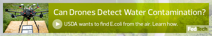
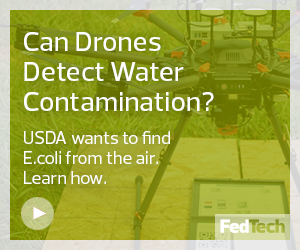
- Drone mapping: Agencies can fly drones over areas to create 2D maps of specific locations. The key component needed, besides a camera, is photogrammetry, according to Jones, which is essentially a system that can record and then indicate for the output exactly where a photo was taken and how to take multiple photos and blend them together into one mosaic or map. The higher the resolution of the photos, the more expensive the sensors will be, Bathrick notes. Agencies also need post-processing software to create the maps, Durscher says. DJI has created a software-development kit that allows developers to create mapping applications and other apps that can run on its drones, he adds. Agencies conduct mapping exercises for a wide variety of missions, many of them scientific. For example. The Agriculture Department has been researching whether drones can be used to examine irrigation ponds in the hopes of coming up with a new standard for ensuring that water is safe to use on crops.
- Drone 3D mapping and imaging: 3D mapping is similar but requires photos to be taken from multiple angles, Jones notes. Therefore, the drone’s flight plan has to be designed so that the aircraft can change its camera angle, which may require different flight maneuvers such as pitching and rolling. Bathrick notes that Interior used a drone to create a 3D model of Devil’s Tower National Monument in Wyoming. A quad-copter drone with an electro-optical sensor captured the images and a $3,000 software package was used to process the image. The 3D model was of such a high resolution that the USGS commissioned someone to build a physical model of Devil’s Tower based on the 3D model, according to Bathrick.
- Drone disaster relief: Drones are often used to assist in disaster response. The Federal Emergency Management Agency, within DHS, has an unmanned aircraft systems team that “provides situational awareness by transmitting real-time or near real-time imagery, data or verbal assessment, using multiple technologies,” such as photogrammetry, live video, thermal imaging and LIDAR, to help plan for disaster response and assist in operations. Agencies can use drones for situational awareness or to create interactive, 360-degree images of areas, Durscher says. That can include augmented reality technology to overlay digital information on the image, such as street names and house numbers, to help locate civilians. That is especially helpful in flooding situations, he notes.
- Drone search and rescue: Drones can be used to locate individuals who are missing or lost, and most search and rescue operations rely on low-latency live video feeds, Jones notes. Infrared can help detect warm bodies that are moving through rugged terrain. Drone operators also need software that allows them to set up a grid search of an area via the drone’s flight plan, Bathrick says.
- Drone surveillance: Agencies also use drones for live video surveillance. For example, in fiscal year 2017, U.S. Customs and Border Protection broke records by flying 635 missions totaling over 5,625 hours of flight, according to a DHS report. CBP drones can operate within 100 miles of U.S. borders, and the CBP office that manages drones uses unmanned aircraft, pilots, sensor operators, video cameras, land and maritime radar, communication equipment, and ground control stations for its mission, the DHS report notes.
How Is Drone Data Captured and Stored?
Most commercial drone systems use common data storage mediums, Jones notes. Most that can record video use SD cards that store data either onboard the aircraft or inside the controller unit, he says. After a flight, the SD card can be loaded into a laptop or PC for analysis.
“It’s common, easy to access, but it’s also very light, as you might imagine,” Jones says. “And weight always matters on a UA.”
Durscher says that most smaller drone platforms have limited onboard processing capabilities, so data analytics are typically performed in-flight or after a flight, but the analysis is done on the ground. Larger drones can have more computing capabilities and the ability to perform real-time edge processing in flight.
“I truly believe we will see more of those capabilities in the future so that we get that actionable data during flight or while we are landing the drone,” he says.